

The insight gained from this is invaluable in the fight against deforestation.
Journalist: Björn Audunn Blöndal
Photo/video: KSAT | Björn Audunn Blöndal Anders Krogh | Alamy
Saving the rainforests with free satellite data
Today, Norwegian authorities finance a program that makes available monthly high-resolution satellite data images from the tropical rainforests for free. Kongsberg Satellite Services (KSAT) leads the delivery of this data.
Until recently, the problem has been that few have access to accurate information regarding exactly where they are being cut down and burned.
The world's rainforests are disappearing at an alarming rate: Equivalent to one football pitch every 6 seconds.
RAINFOREST FOUNDATION
Anders Krogh
«Previously, we had to enter the rainforest to document deforestation and illegal logging. Naturally, this is very time-consuming, costly, and also highly hazardous.»
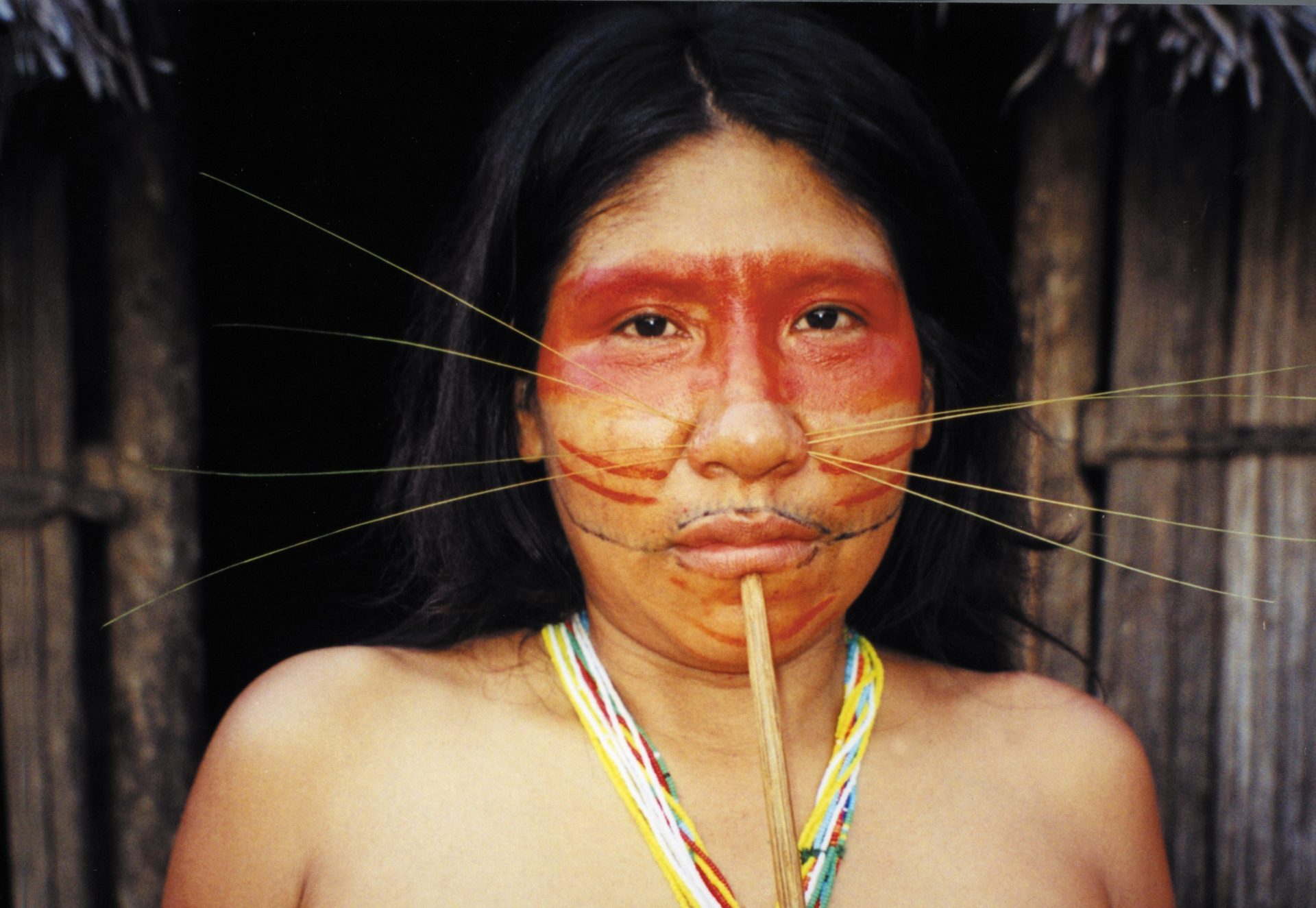
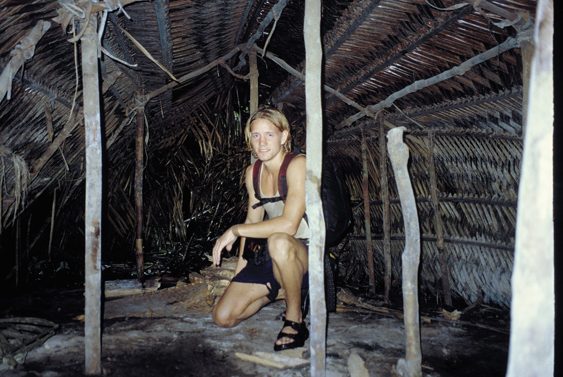
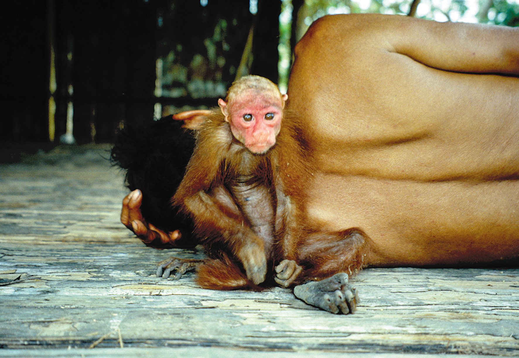
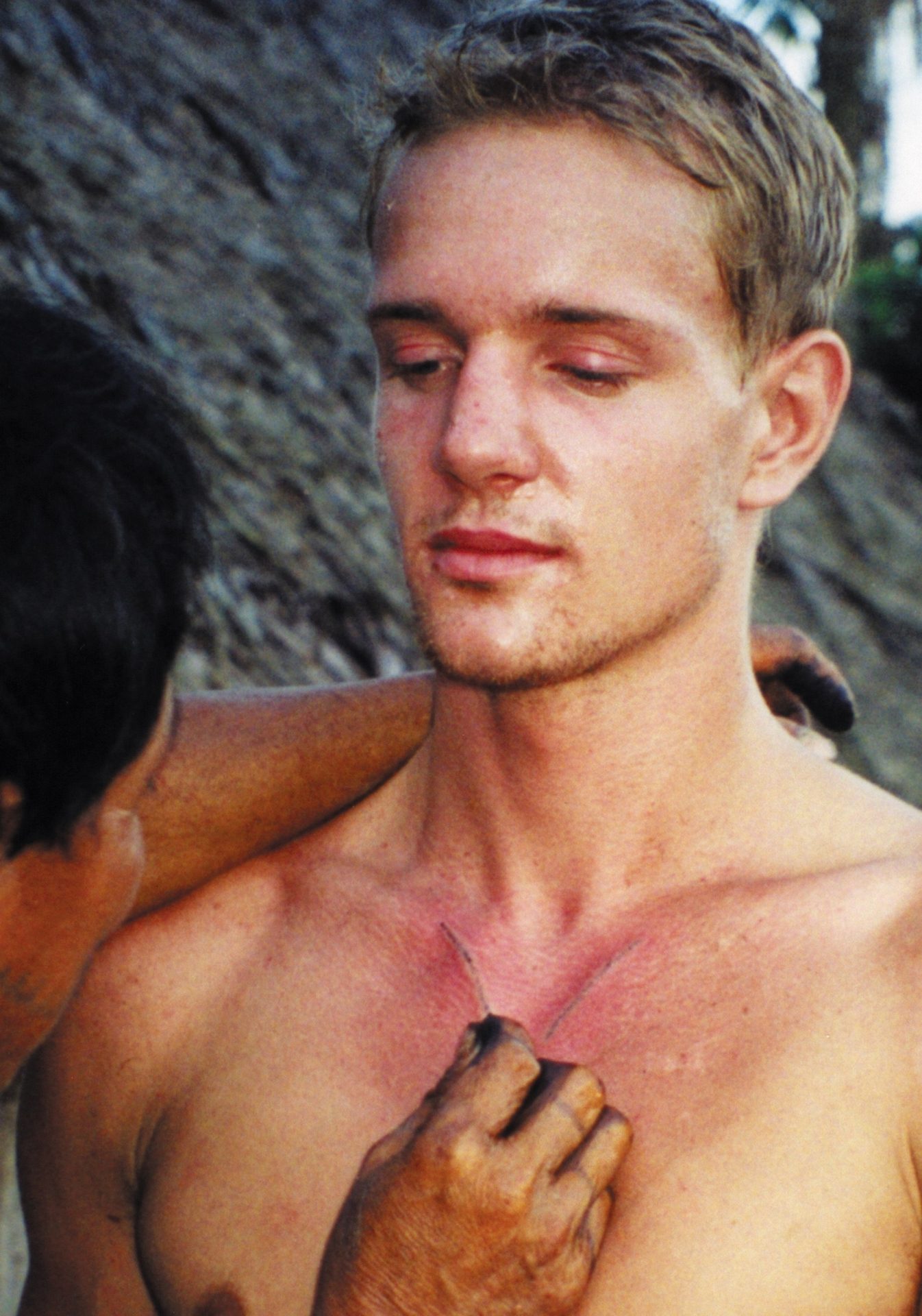
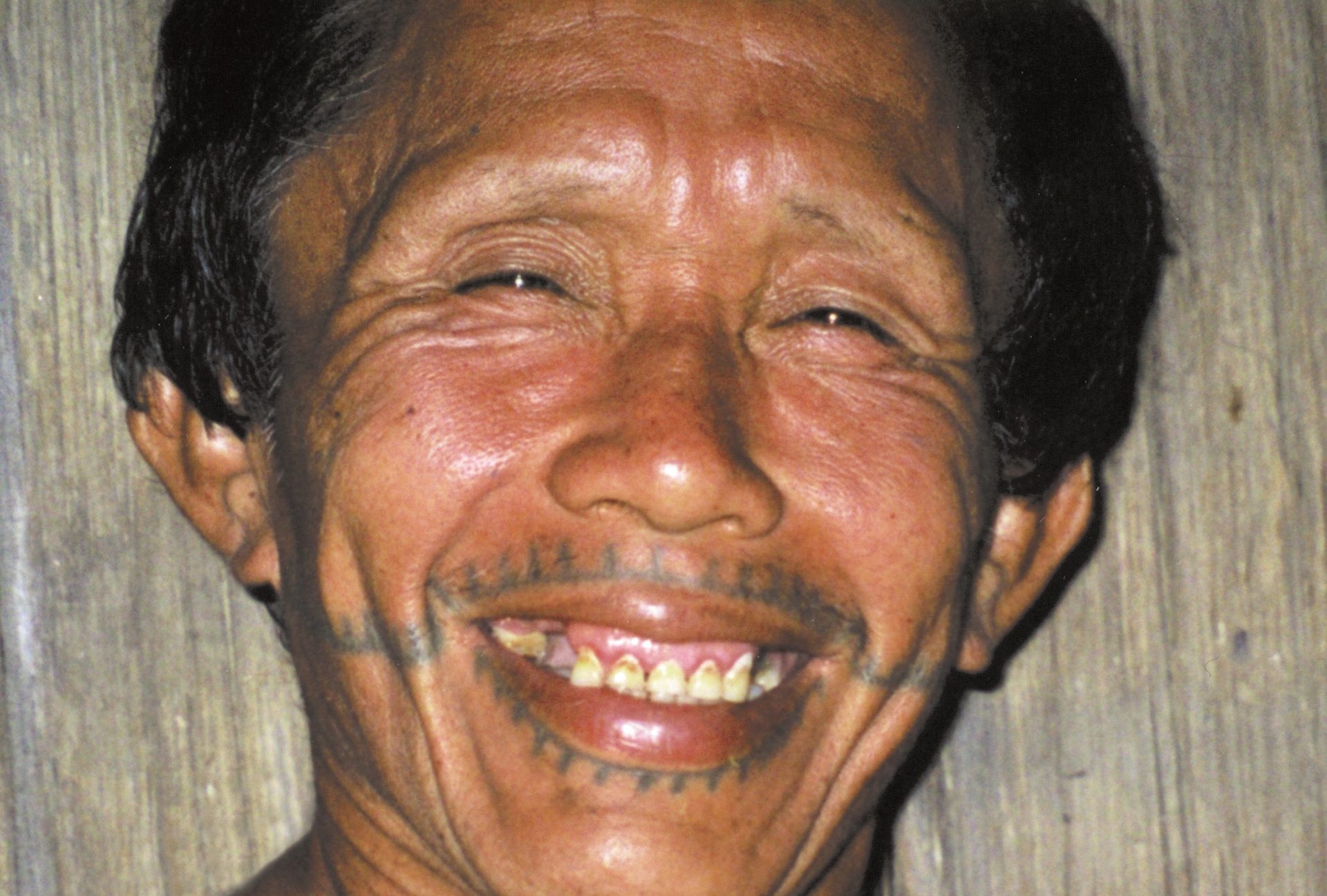
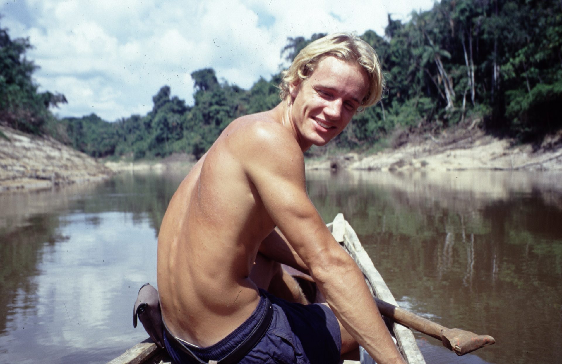
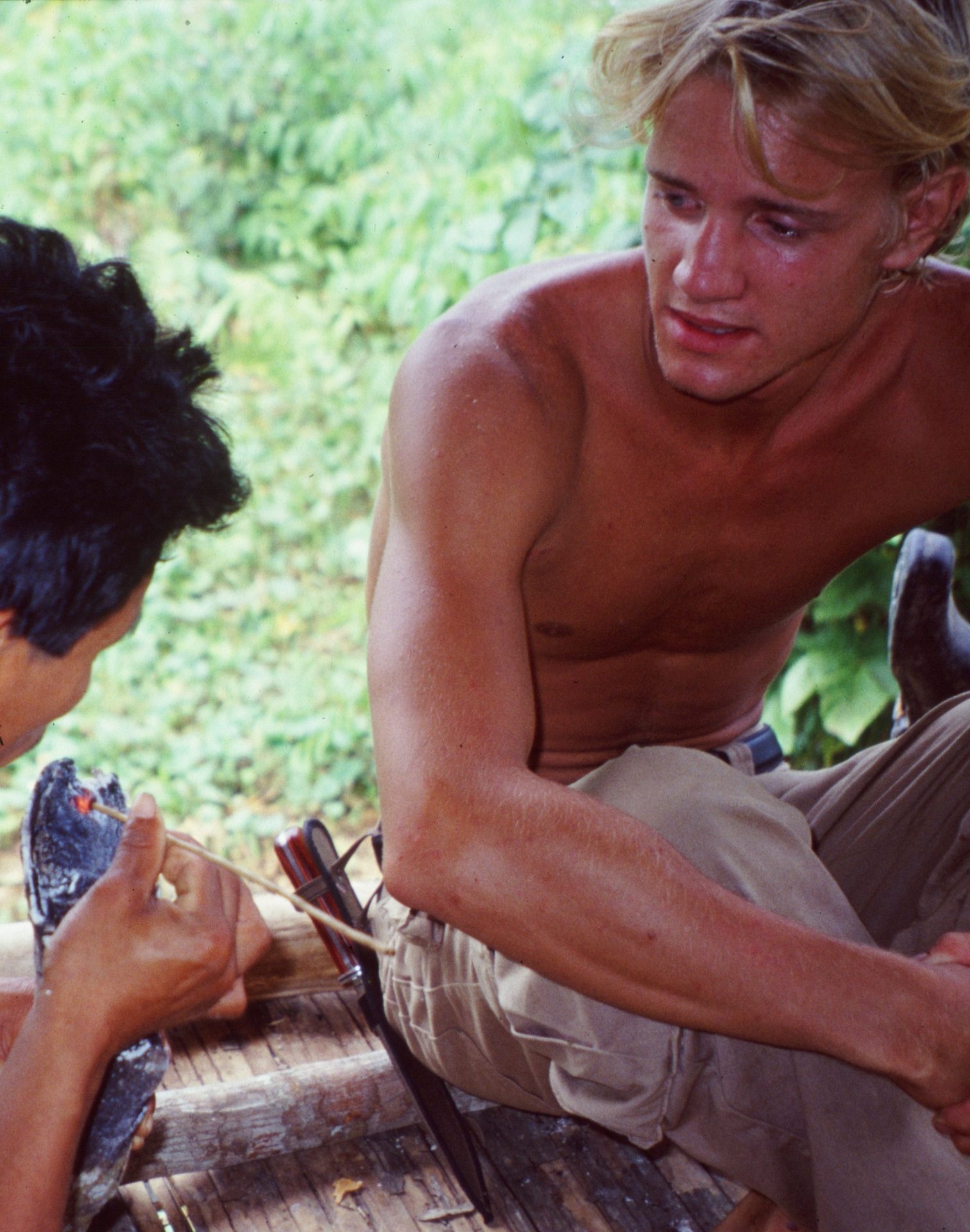
Brutal drug cartels and ruthless mafia groups are behind a good portion of illegal logging. Krogh has first-hand experiences with this. Back in 1999, he travelled to Peru, specifically to Iquitos, a small town on the banks of the Amazon River – a town that even today has no road connection to the outside world. His goal was to live with the indigenous people in the rainforest.
– Iquitos var utgangspunktet for å komme meg videre inn til Yavaridalen, som er et svært isolert regnskogsområde på grensen mellom Peru og Brasil. Her levde jeg sammen med Matses-folket i 14 måneder, forteller han.
– Iquitos was the starting point to proceed further into the Yavari Valley, which is a highly isolated rainforest area on the border between Peru and Brazil. Here, I lived with the Matses people for 14 months, he says.
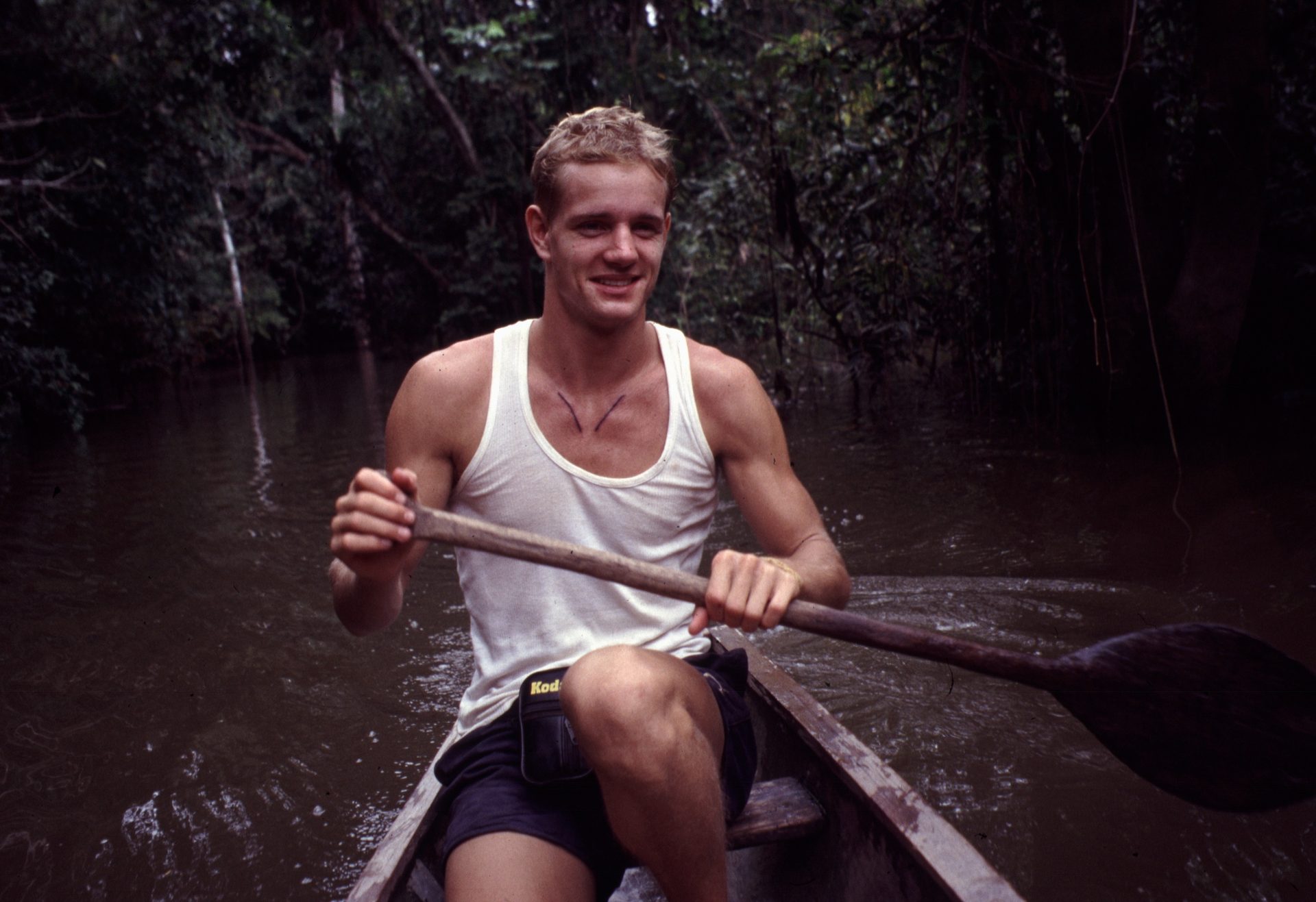
During a journey deeper into the rainforest, Krogh discovered a coca plantation in a well-hidden logging area. He quickly realized that this area was more or less, controlled from a corrupt nearby border post.
He reported the illegal operation to the Peruvian authorities, who promptly dispatched military police to crack down on logging and cartel activities. Eventually, a 10-year ban on timber logging in the Yavari Valley was imposed.
There, he witnessed first-hand the brutal consequences of illegal logging on the rainforest, as well as on the wildlife and the indigenous communities that live in, and off it.
The images he captured and delivered to the Peruvian authorities became crucial documentation of the existence of a previously unknown and undocumented indigenous group.
A lot has changed on the technological front since Krogh's time in the Amazon in 1999. Today, illegal logging in the rainforest can be exposed and documented using satellite data made available by the «NICFI Satellite Data Program» and made possible by and Norway’s International Climate and Forest Initiative (NICFI).
In 2020 NICFI entered into a contract with Kongsberg Satellite Services (KSAT) and its partners Airbus and Planet to provide universal access to such images. The program is a part of the Norwegian Ministry of Climate and Environment, which is financing the program with a total of 40 million USD.
The goal is to share valuable insights that can be used in the fight to preserve the rainforest.
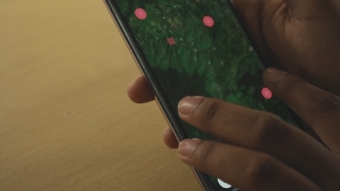
Non-profit organizations, indigenous communities, and governments use satellite data to monitor rainforest activities down to a detailed level – via laptops and even mobile phones.
Non-profit organizations, indigenous communities, and governments use satellite data to monitor rainforest activities down to a detailed level – via laptops and even mobile phones.
The project is sponsored by the Ministry of Climate and Environment with a whopping 405 million Norwegian kroner (appx. 40 million USD). The goal is to share valuable insights that can be used in the fight to preserve the rainforest.
A lot has changed on the technological front since Krogh's time in the Amazon in 1999. Today, illegal logging in the rainforest can be exposed and documented using satellite data from KSAT and Norway’s International Climate and Forest Initiative (NICFI).
14.06.2016
09.10.2017
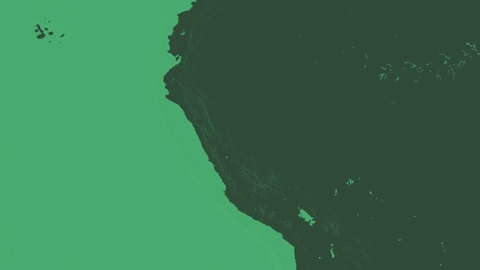
This is how satellite images can reveal illegal logging. Drag the arrow to see.
High-resolution satellite images give us insight into the situation that was previously impossible. Simplified, one could say that only one-third of the original rainforest remains. One third is significantly degraded, but unfortunately, a whole third is entirely gone.
By monitoring the forest over time, we can see development trends and map both legal and illegal activities that affect the vulnerable vegetation in various ways.
Only one-third remains
The Rainforest Foundation itself uses satellite data as documentation in research and reports. This is vital groundwork to influence various authorities and political bodies - and to raise awareness among people in general. Several of the Rainforest Foundation's partner organizations and local indigenous groups use the data daily to monitor areas they seek to protect, he explains.
– We certainly have hope that we can save the rainforest, he says
And this hope is supported by insight - insight into where the forest is being cut down and burned, insight into who is damaging it, and insight into what is needed to regenerate it.
«And to do that, satellite data is a crucial tool. Without the algorithms in place, it would be impossible for us to know how much rainforest is disappearing at any given time»
Anders Krogh
SPECIAL ADVISOR, RAINFOREST FOUNDATION
The direst predictions from scientists pointing out that the Amazon has reached a critical tipping point. This means that we have lost so much rainforest that the entire ecosystem is at risk of collapse. And that is serious. It means that merely stopping deforestation is no longer enough; we must consider how to regenerate, that is to recreate, the forest.
– The situation is not irreversible. The rainforest can be restored," Krogh says optimistically.
– And to do that, satellite data is a crucial tool. Without the algorithms in place, it would be impossible for us to know how much rainforest is disappearing at any given time, Krogh explains.
The Rainforest Foundation itself uses satellite data as documentation in research and reports. This is vital groundwork to influence various authorities and political bodies - and to raise awareness among people in general. Several of the Rainforest Foundation's partner organizations and local indigenous groups use the data daily to monitor areas they seek to protect, he explains.
– This satellite program, delivered by KSAT with partners Planet and Airbus, is ground-breaking. The satellite images covers rainforests in 97 countries. It provides monthly high-resolution satellite imagery across 45M sq km of the tropical forest region as a mosaic dataset ready for analysis and it is available to anyone who needs it – completely free.
And according to Krogh, the fight is essential for the entire world's ecosystem. The rainforest is the world's largest CO2 reservoir in nature. According to the UN, more CO2 is stored in the rainforest than what circulates in the atmosphere. When the rainforest is cut down or burned, this CO2 is released into the air. Global deforestation now accounts for about ten percent of the world's annual emissions.
To achieve climate goals and keep temperature increases in check, preserving the rainforest is a crucial part of the solution. Additionally, 260 million people live in rainforests, and at least half of the world's species reside here. Scientists continuously discover new species of animals, insects, and plants.
– Amazon is perhaps the most crucial biome in the world, Krogh says.
The battle for the world's ecosystem
– The project is incredibly successful, she adds.
Indigenous groups, non-profit organizations, politicians, lobbying groups, law enforcement, journalists, and several user groups download and use the images for monitoring, documentation, and reporting.
– With such detailed documentation of what's actually happening on a larger scale, the program, is creating increased awareness among decision-makers and those who influence them, says Bishop.
– These are data that would have cost a fortune for these many user groups, she adds. The purpose of the program is to ensure transparency and reduce barriers to access. If everyone can see it, there can be no disagreement about what's happening. When we know what's happening in the depths of the world's rainforests, it's much easier for governments to implement targeted measures.
Charlotte Bishop
Senior Project Manager, KSAT
«We see that satellite images are being used to monitor, manage and protect rainforests as well as build knowledge and education to complement traditional methods of conservation».
– We are now in our fourth year of the project and have over 25,000 registered users in nearly 160 different countries. The satellite program is groundbreaking. The satellite images that KSAT delivers together with partners Airbus and Planet, cover rainforest in as many as 97 countries. We download several gigabytes of high-resolution images every month, stitch them together into a mosaic and make the data ready for analysis - completely free of charge thanks to funding from the Norwegian authorities," explains Charlotte Bishop, Senior Project Manager at KSAT.
Ground-breaking
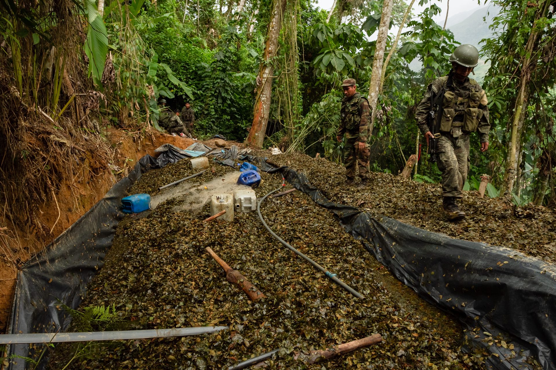
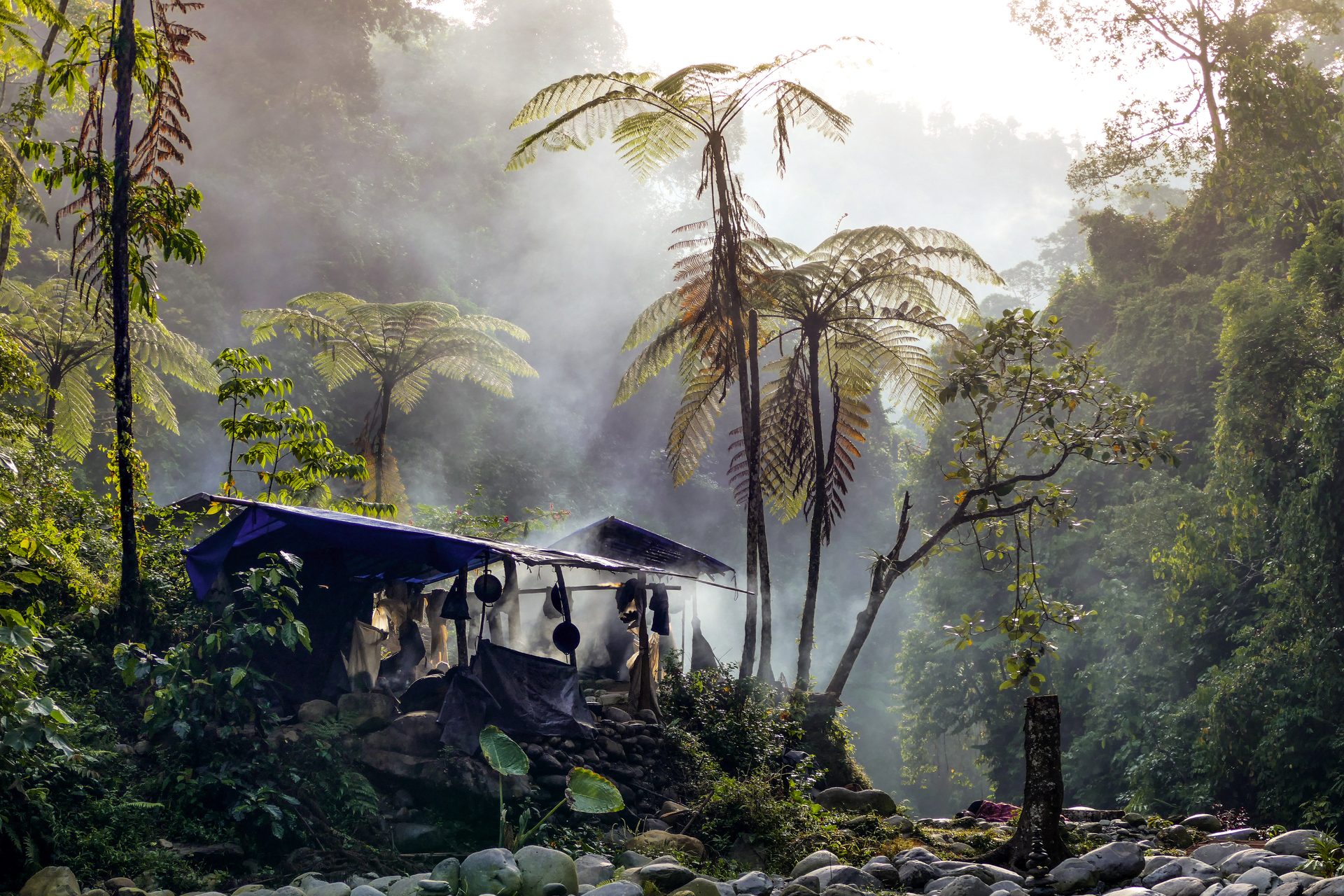
Deep within the Peruvian rainforests live the indigenous Ticuna people. They mainly live by hunting, fishing, and gathering other resources from the rainforest.
The village is located near the porous border areas with Brazil and Colombia - an area that is very difficult for local authorities to control and monitor. This makes it easier for drug cartels to enter, cut down, and burn land to turn it into coca plantations. Until recently, these cartels could cultivate coca with impunity.
Today, the indigenous people and their local guard groups have received necessary training and equipment such as smartphones and PCs with high-resolution images. With NICFI's satellite data at hand, the local population can monitor their vast forested areas – something that was previously impossible.
After effectively cracking down on illegal activity in the conservation area, it becomes apparent that the cartels have stayed away.
Equipped with satellite data deep in the rainforest
Since internet access is limited in the rainforest, satellite images are made available offline through the Global Forest Watch service. The local community's guard committees can plan their patrol routes much more effectively. As soon as the patrol team is alerted to suspicious activity, they head out to gather further evidence. This documentation is then forwarded to law enforcement so that they can effectively crack down on the cartels.
Not only is Leuser a rare intact rainforest, but the ecosystem also acts as a kind of support system for about four million people in the Aceh province.
The ecosystem provides consistent access to freshwater and mitigates the impact of floods during the rainy season. The forests in the Leuser ecosystem act as a sponge, absorbing the heavy rains and distributing the water evenly throughout the year, making the dry period liveable.
Without the rainforest, the rainy season and dry periods would be unbearable for the local population.
The voluntary organization HAkA works tirelessly to combat illegal logging. A significant part of the job involves monitoring forests and reporting new logging areas. And for that, many eyes are needed on guard.
The organization has trained more than 1600 individuals to use satellite data to uncover illegal activities.
Everyone from government representatives, non-profit organizations, researchers, students, police, and journalists has undergone training and now uses Global Forest Watch daily for monitoring.
Approximately half of Indonesia's land area is covered by forests. In the Leuser National Park in North Sumatra, it is the last place on Earth where Sumatran rhinoceroses, orangutans, elephants, and tigers still live together in the wild.
All four species are classified as critically endangered. Unfortunately, the forest areas they live in are threatened by illegal logging.
Local farmers and actors in the palm oil industry are cutting down rainforests to plant vast areas with valuable palm trees. This is happening at a faster pace than the authorities can clamp down on.
An irreplacable natural area
Ikke bare er Leuser en sjeldent intakt regnskog, men økosystemet fungerer som et slags støttesystem for omtrent fire millioner mennesker i Aceh-provinsen.
Økosystemet gir jevn tilgang til ferskvann og demper effekten av flommene i regntiden. Skogene i Leuser-økosystemet fungerer som en svamp som suger opp regnskurene og sprer vannet jevnt over resten av året slik at den tørre perioden blir levelig.
Uten regnskogen ville regntiden og tørkeperioden vært ulevelig for den lokale befolkningen.
Den frivillige organisasjonen HAkA jobber iherdig for å bekjempe den ulovlige hogsten. En stor del av jobben innebærer å overvåke skogene, og rapportere inn nye hogstfelt. Og da trengs mange øyne på vakt.
Organisasjonen har derfor trent mer enn 1600 personer på å bruke satellittdata til å avsløre ulovlig aktivitet.
Alt fra representanter fra regjeringen, frivillige organisasjoner, forskere, studenter til politi og journalister har gjennomgått kurs, og benytter nå Global Forest Watch daglig til overvåkning.
Omtrent halvparten av Indonesias landområder er dekket av skog. I nasjonalparken Leuser i Nord-Sumatra er det siste stedet på jorden hvor Sumatraneshorn, orangutanger, elefanter, og tigre fortsatt bor sammen i naturen.
Alle disse fire dyreartene er klassifisert som kritisk truet. Dessverre trues skogområdene de lever i av ulovlig hogst.
Lokale bønder og aktører innen palmeoljeindustrien hugger ned regnskog for å beplante enorme områder med de verdifulle palmene. Dette skjer i raskere tempo enn myndighetene rekker å slå ned på.
Et uerstattelig naturområde
Not only is Leuser a rarely intact rainforest, but the ecosystem also acts as a kind of support system for about four million people in the Aceh province.
The ecosystem provides consistent access to freshwater and mitigates the impact of floods during the rainy season. The forests in the Leuser ecosystem act as a sponge, absorbing the heavy rains and distributing the water evenly throughout the year, making the dry period liveable.
Without the rainforest, the rainy season and dry periods would be unbearable for the local population.
The voluntary organization HAkA works tirelessly to combat illegal logging. A significant part of the job involves monitoring forests and reporting new logging areas. And for that, many eyes are needed on guard.
The organization has trained more than 1600 individuals to use satellite data to uncover illegal activities.
Everyone from government representatives, non-profit organizations, researchers, students, police, and journalists has undergone training and now uses Global Forest Watch daily for monitoring.
Approximately half of Indonesia's land area is covered by forests. In the Leuser National Park in North Sumatra, it is the last place on Earth where Sumatran rhinoceroses, orangutans, elephants, and tigers still live together in the wild.
All four species are classified as critically endangered. Unfortunately, the forest areas they live in are threatened by illegal logging.
Local farmers and actors in the palm oil industry are cutting down rainforests to plant vast areas with valuable palm trees. This is happening at a faster pace than the authorities can clamp down on.
An irreplacable natural area
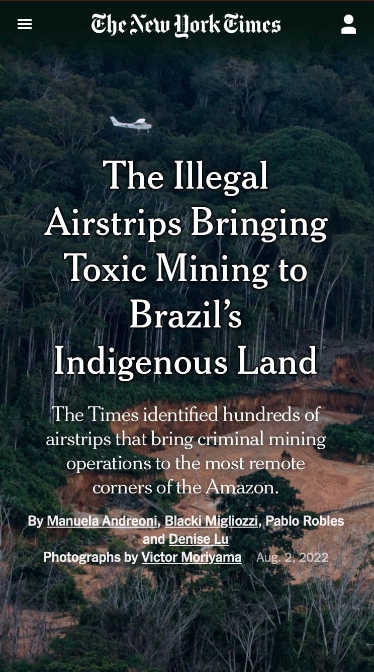
Journalists have also used satellite data provided within the NICFI Satellite Data Pogram to uncover illegal activities in the rainforest. The New York Times recently ran an extensive investigative report revealing how mafia groups are building their network of airstrips in the Brazilian part of the Amazon.
The goal of these cartels is to develop a transportation network around their illegal mines. Through meticulous scrutiny of satellite data, journalists found over 1200
illegal airstrips.
This activity harms indigenous people's lands and threatens their way of life, in addition to causing irreparable damage to the rainforest.
These airstrips allow cartels to scale up gold and tin mining operations to an industrial scale in naturally
inaccessible locations.
From 2010 to 2020, illegal mining on indigenous lands increased by almost 500 percent and on conservation areas by 300 percent, according to an analysis by Mapbiomas, a Brazil-based coalition of climate-focused non-profit organizations and academic institutions.
Brazil's former President Bolsonaro faced constant criticism for not combating this extensive activity. Instead, he scored a political point by supporting miners and even allowed himself to be photographed at one of the illegal mines.
Today, President Lula da Silva has taken over, and Brazil now has a regime significantly more inclined to reduce deforestation in the Brazilian Amazon.
Investigative journalism supported by satellite images
– The regime change in Brazil is very positive for the rainforest. Deforestation in Brazil may have been reduced by as much as 60% - just this year.
– It's precisely the indigenous people who are key to preserving much of the rainforest in the Amazon, Krogh explains. Roughly 70 different isolated indigenous groups live in the Amazon rainforests. Together with local partners, the Rainforest Foundation has helped secure reserves the size of the Netherlands for isolated indigenous people.
– And we are in the process of securing even more areas,
he says. We also see a very positive trend in Indonesia, where deforestation has decreased significantly in recent years.
– The positive message we can convey is that it is entirely possible to save the rainforest. It can be regenerated. And it won't adversely affect the economic well-being of those living in the rainforest. It's merely a matter of willingness.
– We certainly have hope that we can save the rainforest, he concludes.
And this hope is supported by insight - insight into where the forest is being cut down and burned, insight into who is damaging it, and insight into what is needed to regenerate it.
"It's precisely the indigenous people who are key to preserving much of the rainforest in the Amazon."
Anders Krogh, Rainforest Foundation
More stories from Kongsberg Gruppen


– Det gir oss muligheten til å ta pulsen på jorda
– Det gir oss muligheten til å ta pulsen på jorda
– Et industrieventyr gjennom 200 år
– Hvis du er opptatt av det nyeste innen robotikk, er dette stedet