


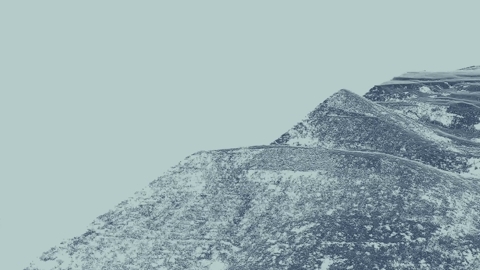
Climate-related natural disasters have multiplied fivefold in the last 50 years. And we can expect more and worse weather in future.
Drones are already saving lives here in Norway and around the world.
Can super-fast, autonomous drones become a common tool to deal with nature's destructive forces?
The Norwegian police are thinking ahead and looking to use drones to make emergency response more efficient.
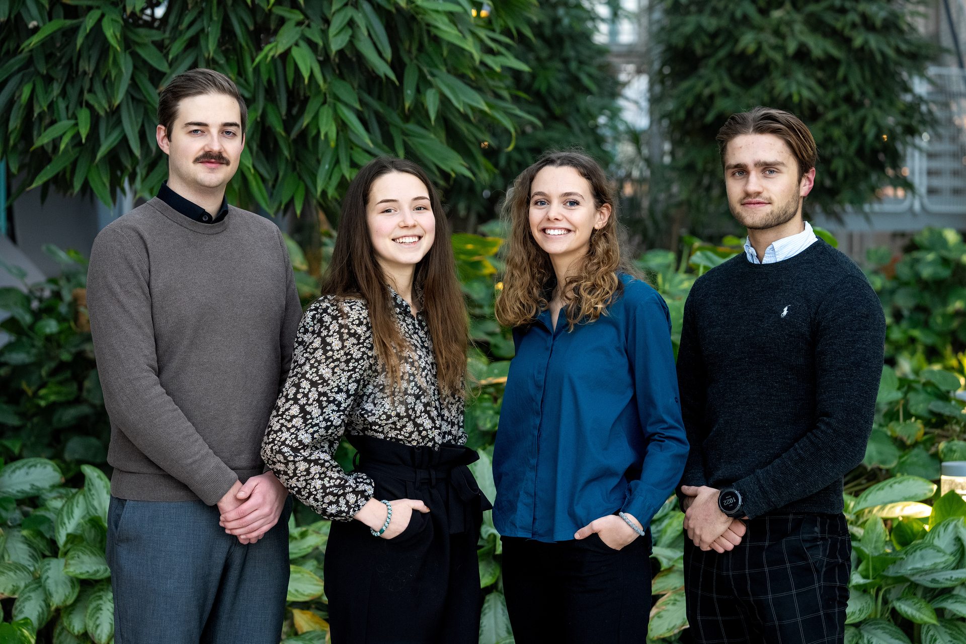
Henrik Nilsen is a student at NTNU in Trondheim and part of the team that were the 2023 winners of Your Extreme, an annual student competition hosted by Kongsberg Gruppen, with their entry dubbed 'Pathfinder'.
“The advantage of high-speed drones is that they're operational all the time. They obviously need maintenance, but can be ‘awake’ 24 hours a day, providing invaluable data to rescue teams who know little about a situation before they get there,” says Henrik.
The students' Pathfinder case study proposes a self-driven emergency response system featuring a network of automated drones equipped with relevant sensors. The idea is to send ahead a swarm of fast drones to feed real-time data back to the rescue apparatus. The goal is to use AI in the form of machine learning to continuously improve the accuracy and speed of information emergency crews receive.
Henrik Nilsen
Student, NTNU, Trondheim
Dream team: Benjamin Pettersen, Siri Mostad Larsen, Marthe Kupen, and Henrik Aleksander Nilsen from NTNU won Your Extreme 2023 with their Pathfinder entry, which explores the use of super-fast drones for first response in accidents and natural disasters.
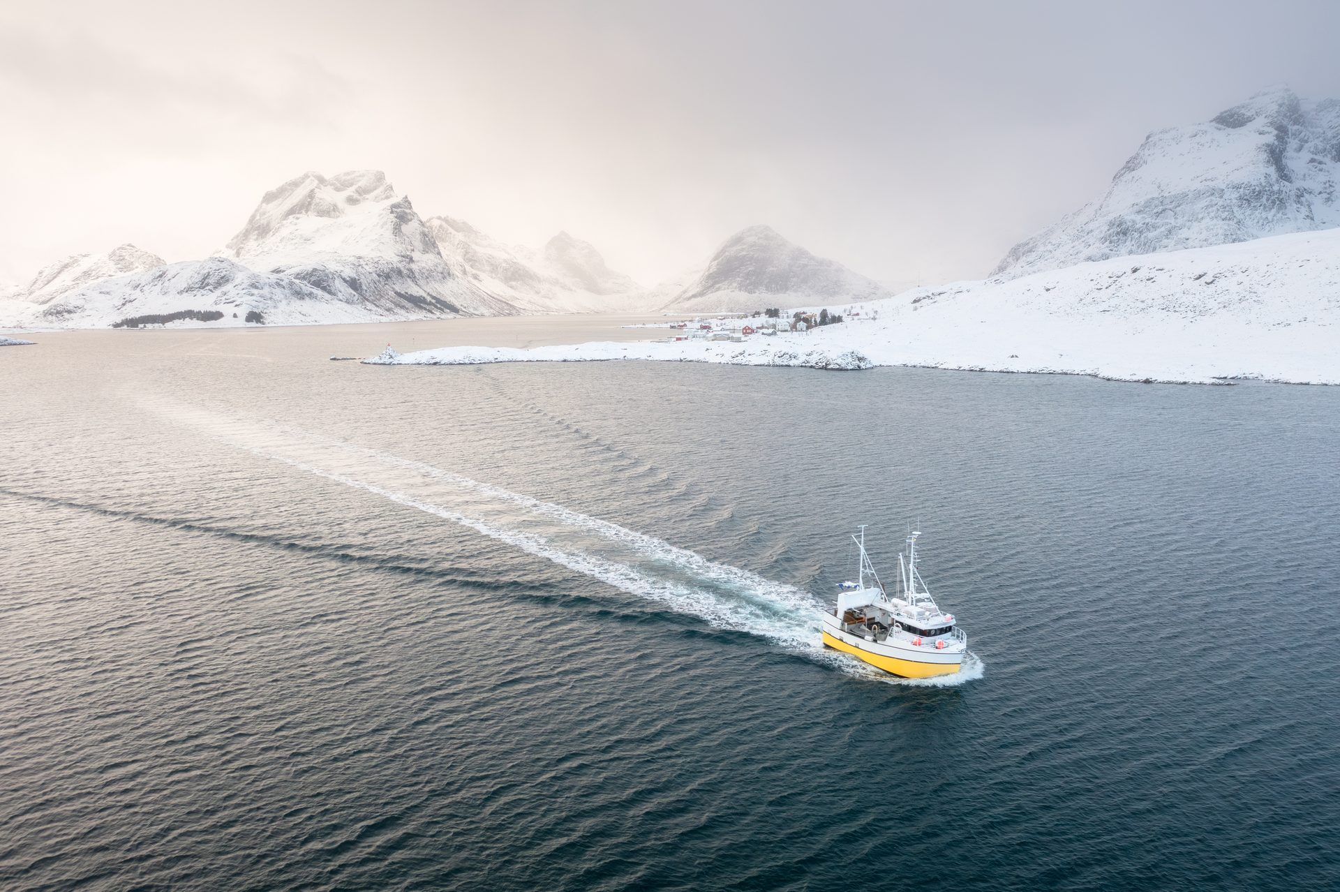
Bigger floods, stronger winds, wildfires, avalanches, and landslides. There's a lot of weather in store that could put human and animal life at risk. A crisis always brings a sea of uncertainties: Where are the injured? What's stopping emergency crews from reaching them? Is there a fire? What gear do you need to deal with the situation?
The world's fastest drone – although still a prototype – is a pppQuadcopter XLR-V3, with an average speed of 360 km/h and a top speed of 414 km/h. It can fly in a straight line covering the same distance in three minutes as emergency crews can cover in 30. Plus, the data drones collect and transmit while police, firefighters, and ambulances rush to the scene could very well make the difference between life and death.
"We saw huge potential to lower the response time of the emergency system and wanted to explore how drones can help the police, fire services, and others to become even more effective."
A swarm of superheroes
Journalist: Tina Aasen
Photo/video: Peik W. Wieland. | Jonas Amundsen | DJI | Alamy | Artlist
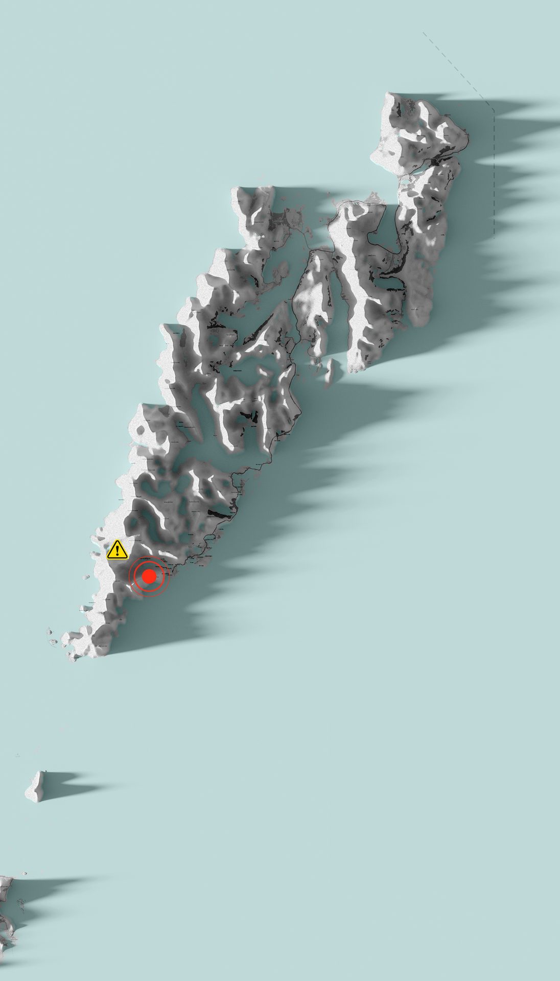
68.023044,N 13.132999 S
Breiatinden, Moskenesøya, Lofoten
Cloudy
29 m/s
67° 50' 25.386" 12° 52' 19.4484"


Cloudy
17 m/s
Breiatinden, Moskenesøya, Lofoten
Conditions
36,6 C°
#2 Accident victim
Body temp:
#1 Accident victim
Body temp:
34,6 C°
Emergency crews can get live images from the accident site.
Drones enable rescue teams to find missing people in rough terrain and dense forests with the help, for example, of heat-seeking (thermal) cameras.
The police are exploring the possibility of having a joint operations center to monitor information from first-response drones sent ahead in the event of accidents, fires, and major disasters. Here are some images from the DJI Matrice 300-RTK drone, widely used today by the fire service, police, and emergency crews.
Ambulance teams as well as fire and rescue services can form a picture of what's happened while making their way to the site. This can save precious time and help them make informed decisions about what equipment they need, for example.
Your Extreme is an annual competition organized by Kongsberg Gruppen, USN (University of Southeast Norway), and NTNU.
The two winning entries in 2023 were Pathfinder at NTNU and AquaClean at USN, a system for protecting marine biodiversity using technological solutions – with a focus on the invasive species, sea squirt.


Your Extreme
Jonas Amundsen
"We use IR (thermal) cameras from a good height to see where it's still hot and where there's a danger the fire could flare up again. It's much more efficient than combing an area on the ground."
Info om kroppstemperatur, bruddskader og andre skademeldinger, 3D-mapping av skred eller bygninger, rapportering av sperringer i veien, som steiner eller trær – alt er uvurderlig informasjon som superraske droner kan gi til hjelpemannskap som er på vei.
Superraske droner må være lette for at de skal kunne bevege seg i toppfart. NTNU-studentene foreslår å ta i bruk teknologi som alt finnes på markedet kombinert med blant annet computer vision (KI som hjelper maskiner med å tolke bilder). I hovedsak sensorer som varmesøkende kamera og Lidar, en laser som sender ut millioner av lyspulser med en stor grad av nøyaktighet, og gjør oss i stand til å se verden i 3D. Ved hjelp av Lidar kan man blant annet lage nøyaktige 3D-kart av landskapet, og den er også nyttig for å måle avstanden til et objekt. Lidar fungerer godt i mørket og under vann.
I sin utredning utforsker politiet nå hvordan dronetjenesten kan utvides fra 100 dronepiloter til 300-400, ifølge UAS. Det betyr at man kan ha en pilot på vakt i alle politidistrikt døgnet rundt. Politiet ønsker også å utrede om DFR-droner (Droner som første respons) kan styres fra en operasjonssentral et annet sted i landet. Det vil gi helt nye og fleksible muligheter for kjapp respons ved katastrofer, ulykker og andre hendelser.
– Ved hjelp av Lidar, varmesøking og computer vision kan man øke sjansene betraktelig for å finne overlevende i for eksempel et snøskred. Redningsmannskapene kan motta viktig info om de overlevendes kroppstemperatur, hvem som er mest i nød og sende nøyaktige posisjonsdata i de kritiske minuttene, sier Henrik Nilsen.
Kan styre førsterespons-droner fra en sentral
«Ved brann kan man bruke maskinlæring til å predikere spredningsmønstre og estimere hvor lang tid det vil ta før brannen sprer seg»
Henrik Nilsen
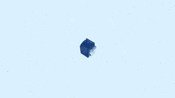
DJI Matrice 300 RTK
During the rescue operation in Gjerdrum, the fire crews used a large, robust, and stable Matrice 300 RTK drone that can withstand a lot of adverse weather. Wind can be a challenge for small and quick drones, but speed is also an advantage. The faster a drone can fly in the wind, the better.
Laser avstandsmåler med rekkevidde på 1200 meter.
Thermal camera
Lidar
Camera
Positioning
Flight characteristics

Top speed: 23 m/sek.
Flight time: 55 minutes
Max wind resistance: 12 m/sek
Anti collision system
Payload capasity: 2,7 kg
Flight characteristics
Sensor for hyper-accurate positioning data.
Positioning
High-resolution camera with 23x optical zoom and night mode.
Camera
Lidar module creates accurate topographical 3D maps of the area.
Lidar
A thermal camera makes it easier to find missing persons. The function is also invaluable for extinguishing forest fires.
Thermal camera


Rotate
Zoom
Top speed: 23 m/sek.
Flight time: 55 minutes
Max wind resistance: 12 m/sek
Anti collision system
Payload capacity: 2,7 kg
Sensor for hyper-accurate positioning data.
High-resolution camera with 23x optical zoom and night mode.
Lidar module creates accurate topographical 3D maps of the area.
A thermal camera makes it easier to find missing persons. The function is also invaluable for extinguishing forest fires.

Rotate
Zoom
During the rescue operation in Gjerdrum, the fire crews used a large, robust, and stable Matrice 300 RTK drone that can withstand a lot of adverse weather. Wind can be a challenge for small and quick drones, but speed is also an advantage. The faster a drone can fly in the wind, the better.
DJI Matrice 300 RTK
Top speed: 23 m/sek.
Flight time: 55 minutter
Max wind resistance: 12 m/sek
Anti-collision system
Payload capacity: 2,7 kg
Sensor for hyper-accurate positioning data.
High-resolution camera with 23x optical zoom and night mode.
Lidar module creates accurate topographical 3D maps of the area.
A thermal camera makes it easier to find missing persons. The function is also invaluable for extinguishing forest fires.
Rotate
Zoom
During the rescue operation in Gjerdrum, the fire crews used a large, robust, and stable Matrice 300 RTK drone that can withstand a lot of adverse weather. Wind can be a challenge for small and quick drones, but speed is also an advantage. The faster a drone can fly in the wind, the better.
DJI Matrice 300 RTK
More stories from Kongsberg Gruppen
HISTORIE